Forschungszentrum Jülich (FZ Jülich; www.fz-juelich.de) is one of the biggest research facilities in Germany. Within the scope of the SPECTORS project, FZ Jülich is developing remote sensing and data processing technology for precision farming as well as for increasing the digitalization in agriculture.
Research in FZ Jülich
There are three core research focuses in FZ Jülich: Energy, Information Technology, and Bio-Economy. Inside the Bio-Economy field, there is the Institute of Bio- and Geosciences: Plant Sciences (IBG-2), in which the Shoot Dynamics Group is responsible for the SPECTORS project. The team aims at developing remote sensing and airborne approaches in advancing plant-based agricultural applications, in particular phenotyping and precision agriculture. One major contribution is a lodging assessment approach that is based on canopy height.
Lodging assessment using canopy height
In agriculture, lodging refers to the permanent displacement of crops from the upright position, which can lead to a reduced yield. Traditionally, lodging assessment is conducted via manual field surveys that are not only time and cost consuming, but also subjective. To obtain an efficient and accurate approach, which can objectively quantify lodging, FZ Jülich decided to use unmanned aerial vehicles (UAVs) to acquire high spatial resolution data. With the use of UAVs, FZ Jülich successfully derived canopy height from RGB data, which can then be used to quantify the lodging percentage and lodging severity of barley.
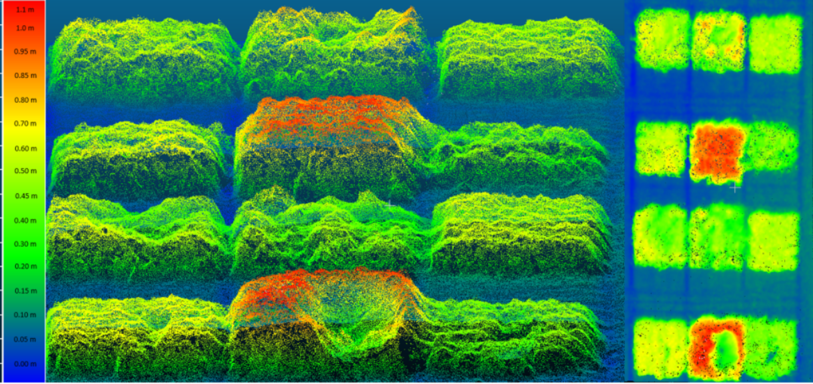
The developed lodging assessment process was done using a predefined threshold at which the lodging occurs. Unlike many traditional and subjective approaches, FZ Jülich determined the threshold by using a mathematical technique. Using the lodging percentage thresholds, a precise detection of lodged areas was obtained which enables the further assessment of lodging severity.

The developed lodging assessment approach had been tested on datasets with different ground sampling distances. The results were promising – even at the highest flight altitude (100 m), the developed approach still let to a high accuracy. This increases the practicability of the developed approach especially for larger agricultural fields where fixed-wing UAVs are often used.
Furthermore, the approach was proven to be more independent from external conditions compared to other methods that used texture or thermal differences. Thus, it can be applied in real-world applications such as insurance matters, precision farming and breeding research.
HyPlant for vegetation monitoring
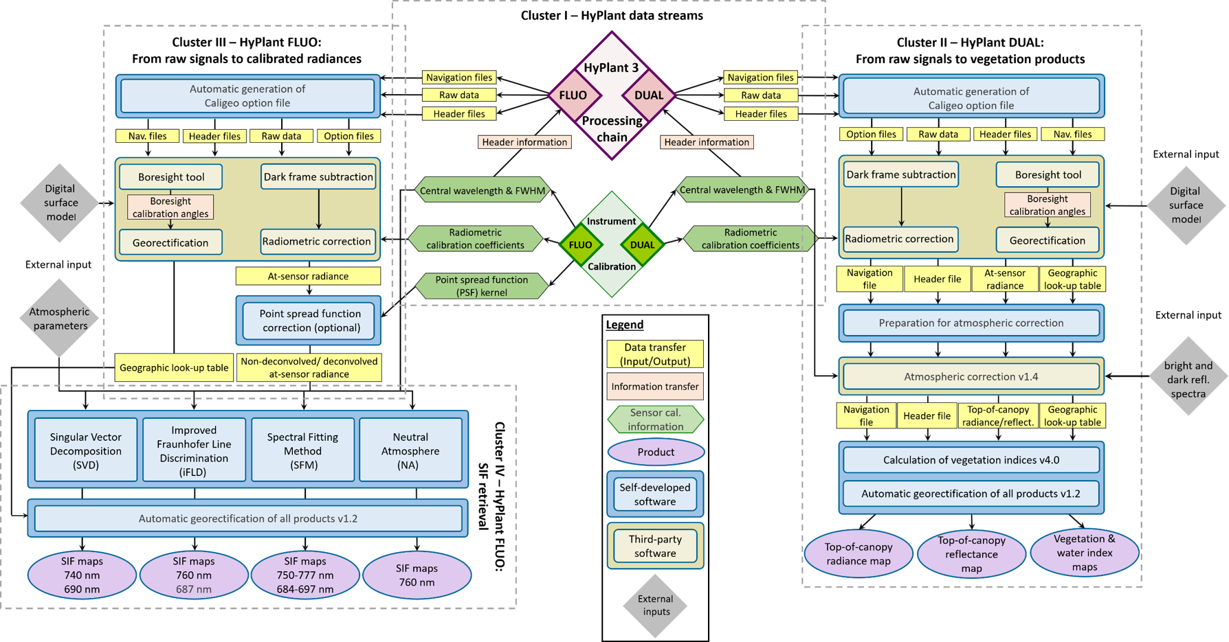
Apart from the lodging assessment project, FZ Jülich had further developed its airborne sensor processing chain within the SPECTORS project. HyPlant is a high-performance airborne imagining spectrometer for vegetation monitoring developed by FZ Jülich (in cooperation with SPECIM Spectral Imaging Ltd in Finland) and is dedicated to measure sun-induced chlorophyll fluorescence (SIF). SIF is a very tiny signal (650 – 850 nm) which is emitted from leaves during the process of photosynthesis, and is crucial for monitoring the current status of vegetation.
Choice of UAVs
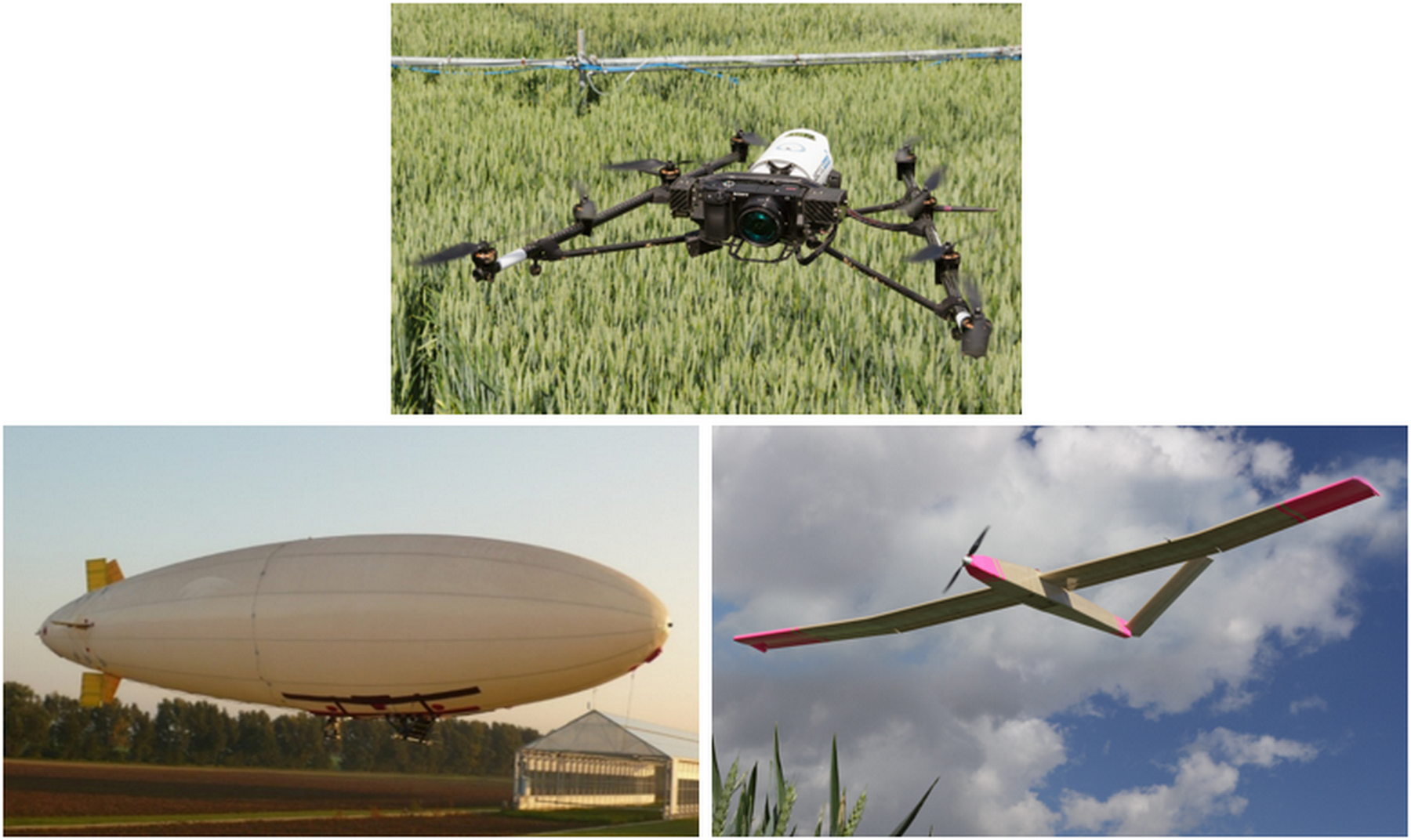
Depending on the payload and the study area, FZ Jülich chooses the most suitable UAV platform for the task. There are three types of UAV platforms available at IBG-2: multicopter, fixed-wing glider, and airship.
From their experiences, the multicopter platform is a perfect platform for positioning an imaging sensor over agricultural experimental fields because of its capability of maintaining an accurate hovering position.
A fixed-wing glider, in comparison to a multicopter, offers a better stability and longer flight duration. Therefore, it is well-suited for mapping larger agricultural areas such as the experimental field affected by lodging shown above. In 2016, FZ Jülich together with the company Aeromedes built a fixed-wing glider (named “Field Glider”) with a wingspan of 4 m and a flight duration of 40 minutes.
A 10 m sized Helium-filled airship that can be flown over agricultural areas for a long period of time was acquired in 2013. The high payload (maximum 5 kg), the smooth flight and low vibrations make the airship a great platform for scientific tools, complementing other small UAV platforms.